The Epic Timberline Trail: A 5-day Bucket List Hike
The Timberline Trail, a National Historic Trail, circumnavigates Mt Hood in the Pacific Northwest of Oregon. This trail is within the Mount Hood Wilderness inside the Mt. Hood National Forest.
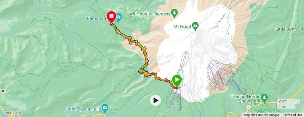
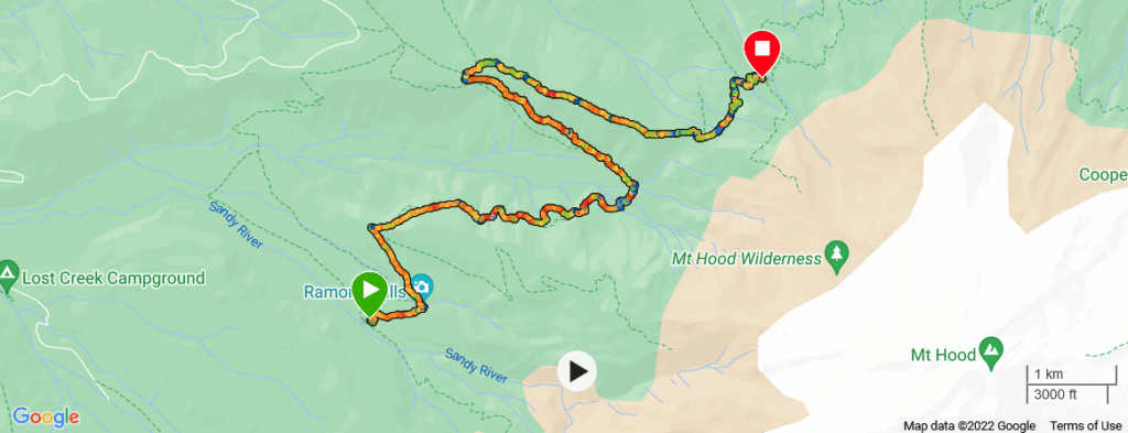
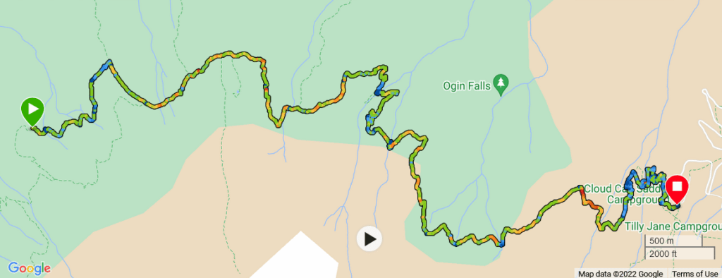
The Forest Service has it listed as 41.4 miles long with an elevation gain of 10,341′, after reviewing many trail reports, and reviews prior to doing the hike I’d say that is fairly accurate, however, you may take detours or side hikes that’ll increase your mileage.
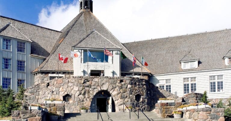
Most people will depart from the Historic Timberline Lodge since there is plenty of room in their parking lot and upon completing the hike there are a few restaurants to enjoy a beverage or two in celebration, not to mention a short distance to the trail.
However, there are other access points that may be more convenient for some.
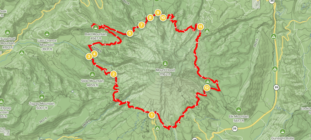
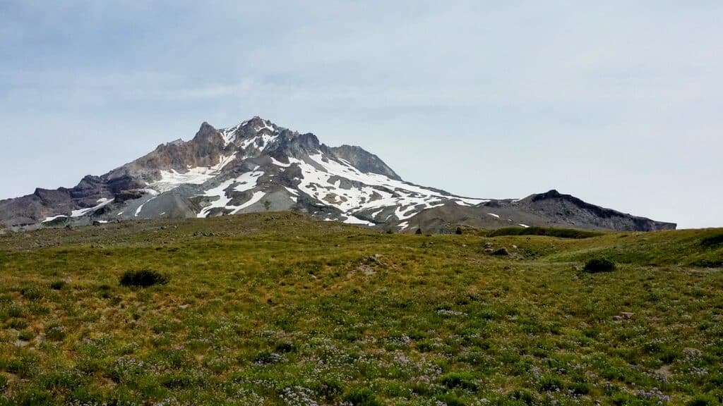
This trail has about 10,300+ feet of elevation gain and you will find yourself fording a handful of river crossings, possibly crossing a snow field or two, walking along steep ravines and canyons, and staring up at glaciers, and many waterfalls too. The scenery and wildlife along this trail are utterly stunning. While this trail can be considered moderate to difficult, it is a popular one.
You’ll come across a few types of visitors on the Timberline Trail, day hikers, trail runners, and backpackers. This trail is also part of the Pacific Crest Trail, which runs from the Mexico and United States border north to Canada (another bucket list item of course). The trail was constructed in the 1930s and is near the tree line.
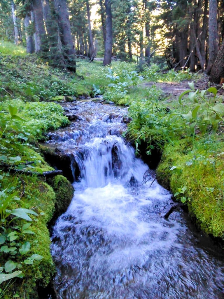
Be prepared to ford many of the glacier-fed creeks and rivers, White River, Muddy Fork, Newton Creek, and Sandy River just to name a few. Late summer and fall are the best times for hiking the Timberline Trail (in my opinion), as most of the trail has been cleared, there’s less snow, and the water levels are more manageable to navigate.
After deciding the Timberline Tail, aka #600, was something we wanted to do, it was time to look for some recruits, that was pretty easy though, as it was on a lot of people’s bucket lists. Up to this point, we’ve had plenty of multiday backpacking adventures so the gear planning was easy, planned our meals and picked some spots we’d like to camp for the night.
Tip: Do not make this your inaugural backpacking trip, this can be a challenging hike and should not be your first.
There are portions of the trail that will really test your nerves and trail conditions are not always optimal making it a difficult hike. Have I scared you away yet?
I hope not, because those that choose to do the Timberline Trail loop will be dazzled with great views of multiple glaciers, views of Mount Saint Helens, Mount Adams, Mount Rainier, Mount Jefferson, and the Three Sisters. Not to mention the alpine meadows.
Day 1
We get to Timberline Lodge, start unpacking all our gear from the car, double-check that we have everything, and check with the others in our party. We went over the rough game plan for the day and where our final destination might be. I say might, since you do not know if someone else has already claimed the spot.
You should do your best to pick an established camp spot so as to not disturb vegetation any more than necessary. We checked in at the climbers’ hut to obtain our permits and write in the log in case there were any issues. Now it was time to hit the trail. Here we go…
We chose the clockwise route, although now I really cannot say why we did, we just did. So leaving the lodge heading West you start the Timberline Trail and it’ll take you through the Timberline Lodge ski resort, you’ll pass under a handful of chairlifts and through fields that are ski runs during the winter and some have mountain bike trails during the summer.
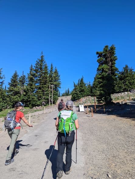
Once you leave the ski resort the Timberline Trail skirts the tree line following the terrain a bit, for the most part, the entire trail is single track, meaning you will be walking single file, rarely are you able to walk side-by-side with your party. Along this section, you’ll be able to look up towards the peak and see White River Glacier and Zigzag Glacier.
The first canyon you’ll traverse is Little Zigzag River, this one is not bad, but soon after you come upon Zigzag River Canyon, this one is a little more treacherous, two female hikers fell to their death over a waterfall in the area a few days prior (we learned this upon our completion of the trail).
The walls in the canyon are steep and the ground is soft and falls away fairly easily, stay away from the edge! No Instagram photos are needed!
At this point, you head up the other side and then start descending at a pretty good pace and start switchbacks to get down the steep terrain. Now that you’ve descended about 2,000′ it is time to hike back up.
A good detour during this section is to hike up Paradise Park Loop trail #778, this one takes you up above the treeline for some stunning views and wildflowers abound.
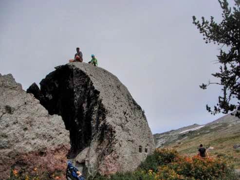
This is a great place to stop for lunch and eat atop, what I’ve dubbed “The Lunch Rock“, reenergize yourself, and take in the scenery. You can either continue on Paradise Park Loop Trail #757 or take the short walk back down #778 to the Timberline Trail and continue on as we did.
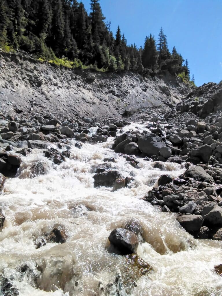
Back down below the tree line, we cross over Rushing Water Creek, at the time of our crossing (August) it was pretty minimal, but then we needed to cross the Sandy River.
This one was a little more sketchy in that it is wider, with lots of large boulders and it was not just one stretch of water, but the river and a handful of courses running through the riverbed, trekking poles come in real handy in these situations.
We continue to make our way down in elevation and just past the point the Pacific Crest Trails veers off onto its own course, we chose to set up camp for the night. A nice wooded area with the Sandy River not too far away for water.
It was time to decompress, relax, converse about our day and eat some fantastic food. By fantastic I mean mediocre at best most of the time, but after a long day on the trail, any food is good, really. So, we broke out the Jetboils and the Mountain Houses and feasted like kings and queens. Knocked out the dishes, manage to get a wet nap bath in, and off to bed.
Day 1 Stats:
- Miles = 10.4
- Total Ascent = 1,615′
- Total Descent = 4,295′
- Min Elevation = 3,261′
- Max Elevation = 6,006′
Day 2
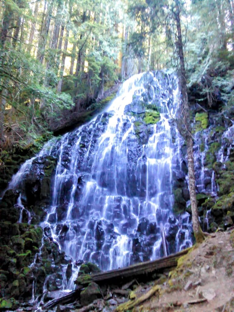
The next morning was rough getting up as it always is the second day of a hike. The body is not used to being beaten up on a trail like that, pushing it, when it does not want to be pushed. I was not in the best of shape back then either. It was only about a mile down the trail to Ramona Falls, this is a sight to see.
It is so mesmerizing just to stand there and watch the water cascade down the rock face. There is a trail, Ramona Falls Trail #797, with access to the trail from Lolo Pass Rd for a day hike, check online for trail conditions before heading out.
Back on The Timberline Trail again, you get glimpses of Reid Glacier and Sandy Glacier, wildflowers everywhere, and a ton of birds. Around mile 13 was our next river crossing, Muddy Creek, pretty easy I thought, no one had any issues.
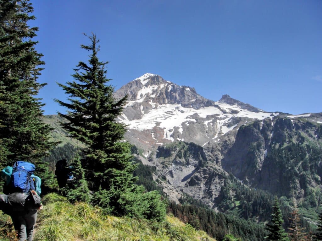
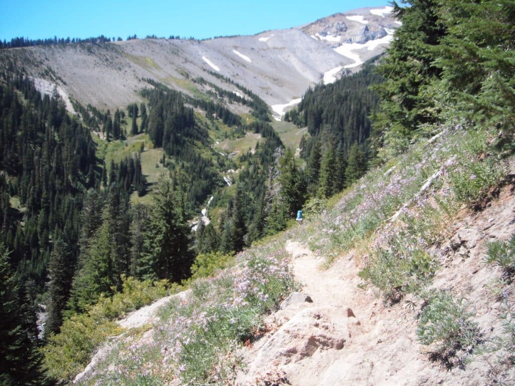
At this point, we had been deep down below the tree line, which in August the shade is welcomed. You’ll traverse both sides of Bald Mountain Ridge and while walking back towards the mountain you have sight of McNeil Point and soon after that Glisan and Ladd Glaciers.

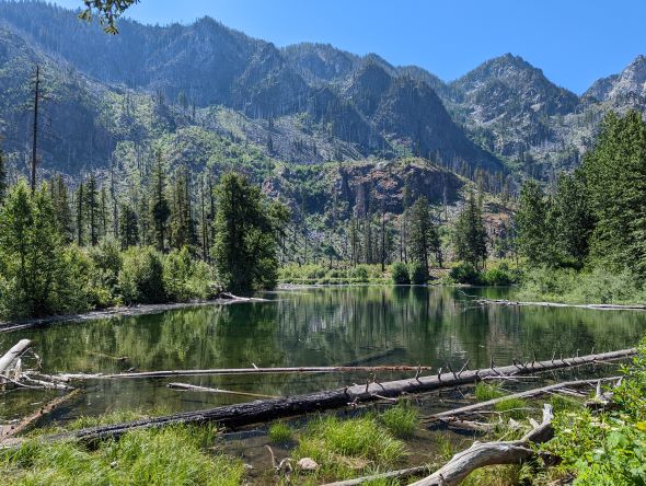
There is a lot of elevation gain this day with periodic episodes of descent, but in general, you just keep climbing and climbing, however, rewarded with spectacular views. There are several creeks that run down through here as well as you are making your way around the mountain.
Keep this in mind as water sources can be a rarety in some areas. McGee Creek, Glisan Creek, and Ladd Creek had decent water when we traveled through and made a good stop to get the group back together and rest a bit with some cold filtered water.
And you must filter this water, it can be very silty and some of the larger creeks/rivers you do not want to attempt to filter, or at least we did not, just too silty. Tip: Have a backup filter of a different type, if one does not work so well maybe your backup will. Stay hydrated!
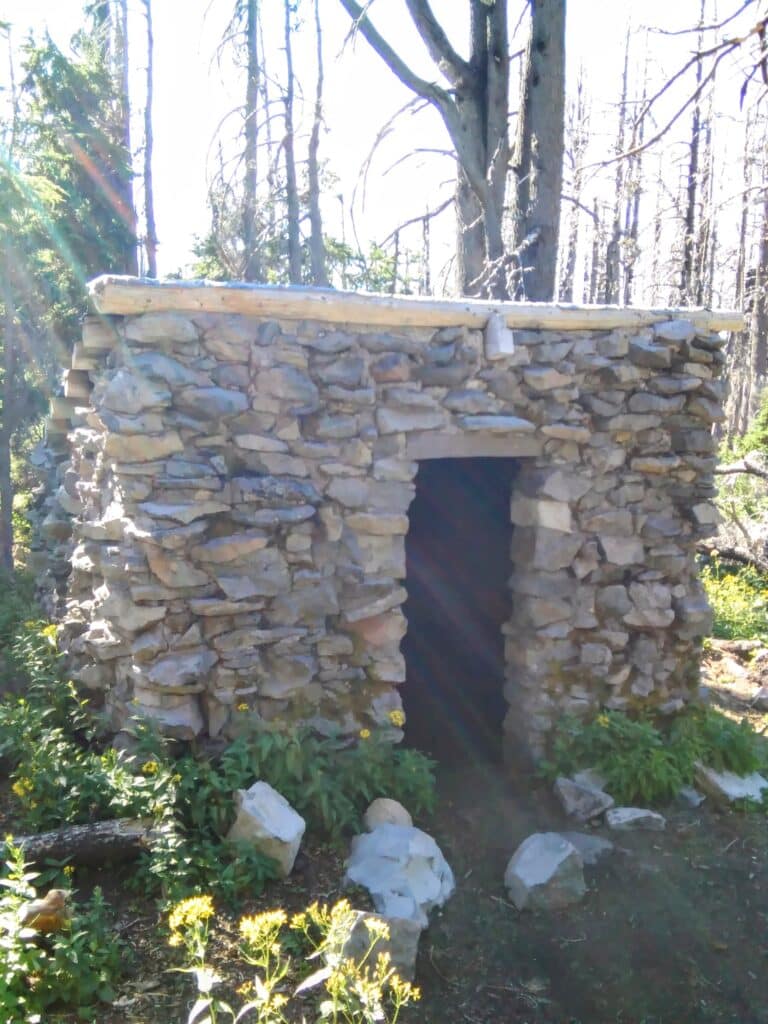
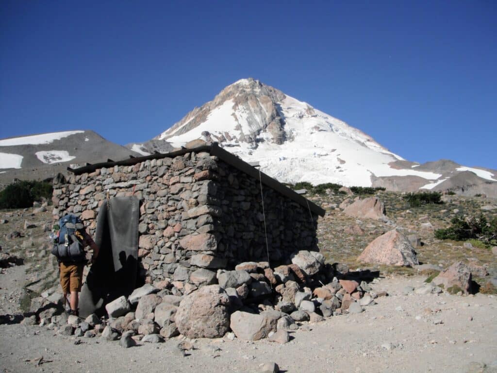
Cairn Basin Shelter and Eden Park area were going to be our camp spot for our second night. The Cairn Basin Shelter is another Historical Landmark, it is one of a handful of shelters that are still standing 90+ years later.
This is a beautiful area minus the previous fire damage trees, but many trees and meadows have grown and are as brilliant as ever. This evening was another feast, but not too much of a jovial one as several of us were beat and quite tired.
Day 2 Stats:
- Miles = 9.23
- Total Ascent = 3,991′
- Total Descent = 1,598′
- Min Elevation = 3,269′
- Max Elevation = 5,743′
Day 3
Another early morning, trying to beat the heat of course. We wanted to make it to Cloud Cap, since we were meeting up with two other people to join us for the rest of the hike, and they were going to be bringing homecooked food and beverages. We had a long way to go, a big river crossing, and one heck of a hill climb ahead of us.
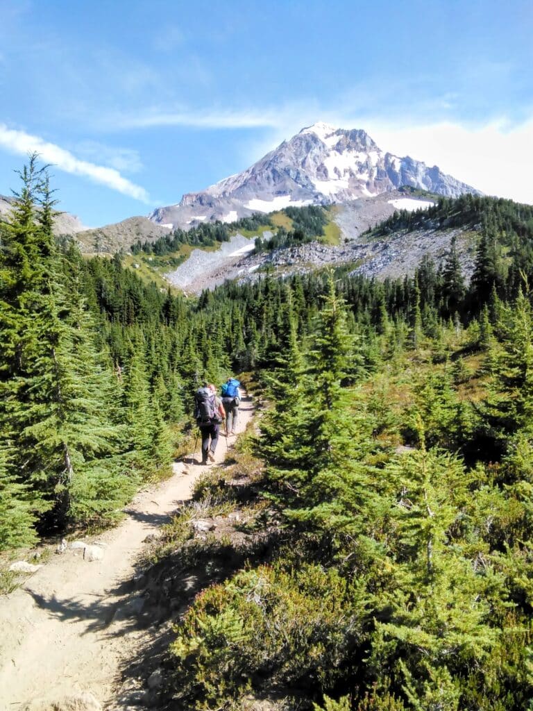
We are back up towards the top of the tree line again and blessed with unobstructed views of Mt Hood as we pass through the stunning Wy’East Basin Meadow and through the Elk Cove area. This section has a lot of campsites for those looking for one. This area is also popular for day hikers coming up from the lower elevations. So the traffic can get heavier in this area.
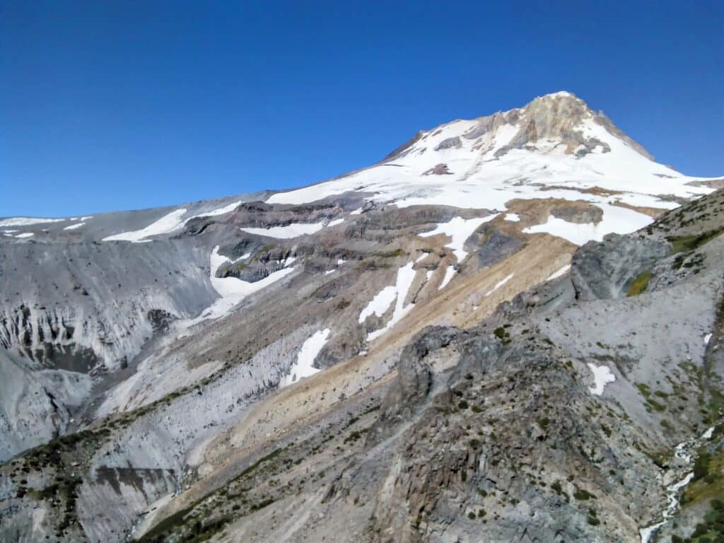
After Elk Cove you have a few switchbacks getting down into Coe Branch Canyon/Ravine, but here you have a pretty nice view of another one of Mt Hood’s glaciers, Coe Glacier. Then it is more switchbacks to get up the other side. There are a lot of small ridges and canyons through this section of the hike and they seem to just go on and on and on.
In your head you keep telling yourself it is all worth it, then you walk around a corner and are smacked with an up-close view of the mountain peaks, and all your doubts just fade away.
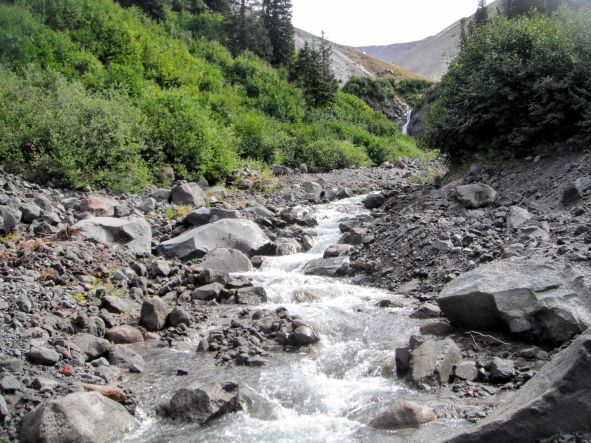
Towards the end of day 3, there is a section of steep terrain and a lot of switchbacks to get down to Eliot Creek, aka Eliot Branch, even in August, there is a lot of water coming off the hill from Eliot Glacier up above.
To this point, this was probably going to be the most technical crossing so far since there were no narrower spots of boulders to jump to. This one was flowing fast and cold. Everyone managed to make it across with no major ordeals. However, a solo hiker coming from the other direction came down the hill.
The person was older but was making their way down the trail just fine. Then they approached the water and we all decided we should stay where we were just in case one of us needed to run back and assist. While it was not the prettiest or driest crossing, this person made it to the other side.
Soaking wet, tired, but undeterred, and proceeding to remove boots and socks for a short drying out period. Once we were able to confirm they were okay we started the climb up the final hill for the day.
Cloud Cap could not have come soon enough. Cloud Cap encompasses the Saddle Campground and the Historic Cloud Cap Inn. The Inn was constructed in the late 1880s and was operated as an upscale inn for climbers, but closed down the business in 1946. For the last 50+ years, the Crag Rats have maintained and improved the structure.
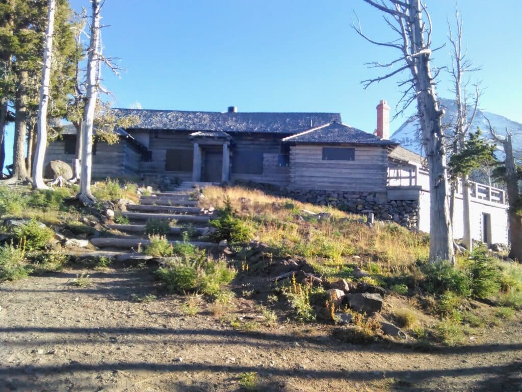
The other Historic building up there is the Cloud Cap Snowshoe Cabin. We were able to secure a spot for all our tents, but it was not back in the protected area of the trees, it was one of the large spots in the middle, and thought nothing of it. Our friends showed up, and we enjoyed a homecooked meal, and just hung out for a while.
We explored the surrounding area, and the climbing lodges and enjoyed a spectacular sunset. Then the winds started to pick up. We had already been in bed when the wind decided to make itself really known and boy did we get acquainted.
It was blowing so hard that the fine dust was making its way into the tent, making a mess of everything, getting into our mouths, noses, eyes, and ears. We did our best to button everything up to keep it on the outside, but it just kept finding a way in.
It made for a very bad night, little sleep, and a pretty grumpy morning. Many thoughts were going through my head during the whole ordeal, I was even planning out my escape from the rest of the hike and how I’d hitchhike down the hill and meet up with everyone later.
Of course, that was not going to happen, but when you are being beaten down by Mother Nature and her relentless wrath, your mind will go in many directions and some dark places too.
Day 3 Stats:
- Miles = 9
- Total Ascent = 2,258′
- Total Descent =1,719′
- Min Elevation = 5,113′
- Max Elevation = 5,973′
Day 4
Well, that night sucked! It was by far and to this day the worst evening I’ve ever had backpacking, and we’ve had some horrible ones. It was time for the big cleanup, I think most of us were up at the crack of dawn or even earlier, itching to get packed and on the trail. Pack, coffee, and start walking.
There is an easily accessible Cloud Cap Trailhead, and there is a fair amount of parking, but it can be a busy place during the summer, with people coming up to camp in the campground there. Also, if you are going to be staying here, make sure you get there in time for sunset, it is one you will never forget.
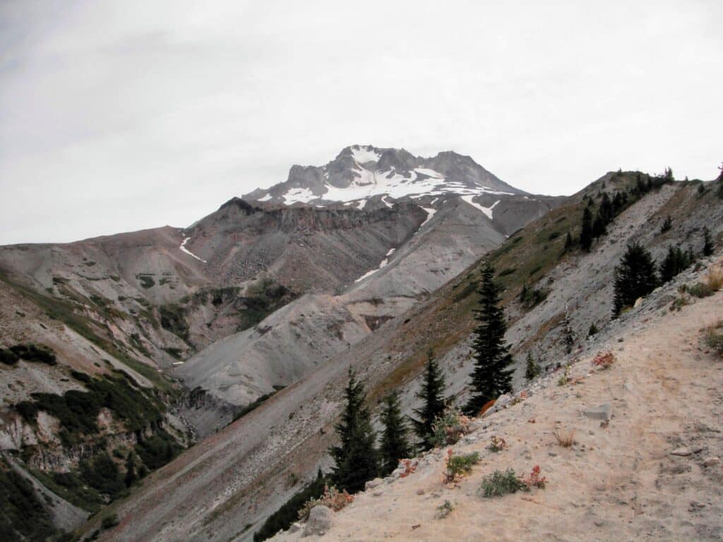
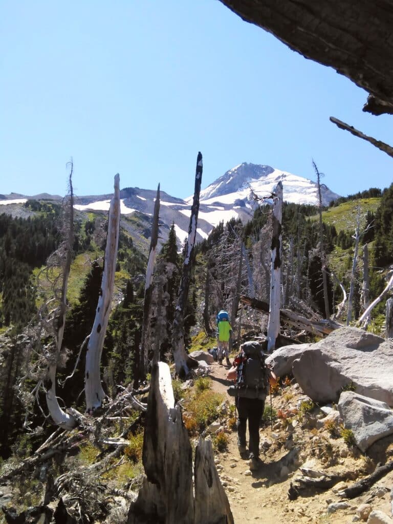
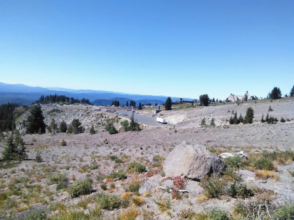
So we are back on the trail and not too far up the trail we exit the tree line and are fully exposed to the day’s elements. This is where the trail softens to sand and gravel and your steps become more intentional.
One of the coolest stone shelter locations is up on Cooper Spur at 6,800′ and a good spot to grab a snack before continuing onto the high point of the entire trail of 7,300+ feet, all downhill from here right… Nope!
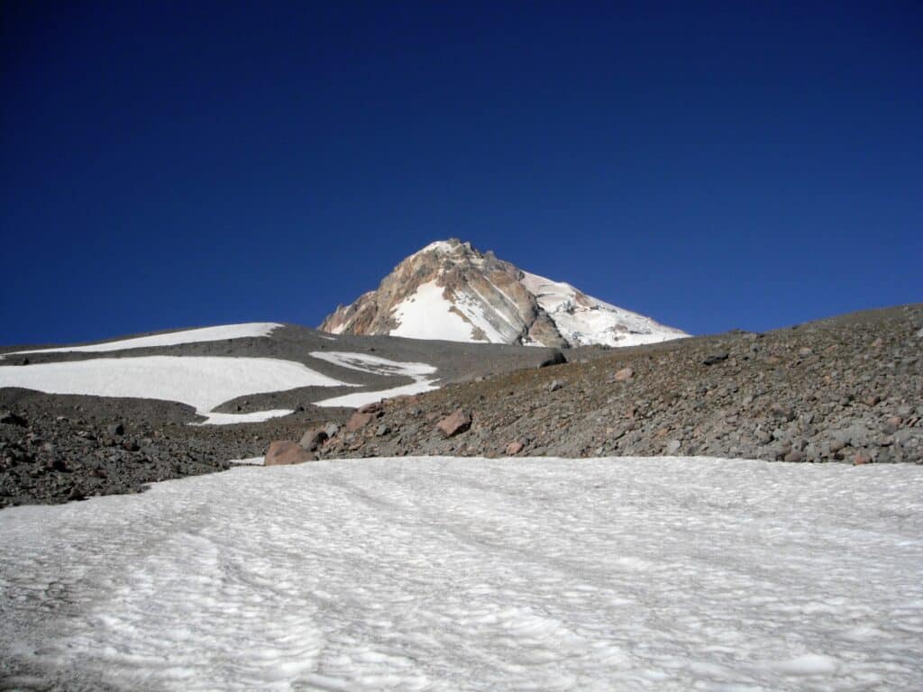
As we continue on we start crossing snowfields, about three of them in total. Then start to drop in elevation for about 1,000′ and drop back below the tree line, not before giving a full-on view of the Newton Clark Glacier, and start traversing and crossing over ridgelines.
Around 33 miles in on the trail, there is an intersecting trail, Gnarl Ridge #652, as well as access down to Elk Meadows. We did not feel like making the detour on this trip. Now, we were going to ford Newton Creek, which was pretty minimal in August.
Up next was cresting the ridge on the East side of Heather Canyon. Those who enjoy the slopes of Mt. Hood Meadows during the winter, know Heather Canyon all too well. It is an entirely different perspective during the summer and from the other side of the canyon.
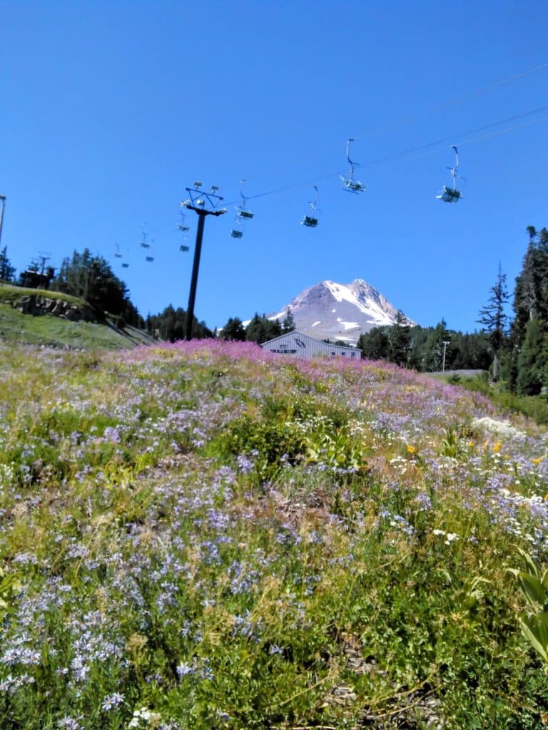
Clark and Heather Creek are additional crossings for the day. Now we are within Mt. Hood Meadows’ Resort boundary, crossing ski run meadows with tons of wildflowers and lift chairs above. You get sort of a second wind seeing more civilization, but after a long day, it does not take long to fall back into the grind.
At this point, we are looking for a place to camp since we had decided not to make the push to the end.
And we did not have rooms reserved at Timberline Lodge until the next evening. There is a small hidden established tent site near Mitchell Creek, in my opinion, the best-tasting drinking water, there was even a beer stashed in the creek from previous hikers, or at least we assumed it was from hikers.
This was a good evening, after a long hot day, a hot meal and of course dessert. The tent spot was in the trees so it was nice and cool and everyone was in good spirits since we only had a few more miles to go the next day, but we knew it would be a good climb up to the lodge.
Day 4 Stats:
- Miles = 10.81
- Total Ascent = 2,706′
- Total Descent = 2,846′
- Min Elevation = 5,381′
- Max Elevation = 7,354′
Day 5
Even though the end was only a few miles away, we wanted to get an early start since a lot of the Timberline Trail would be exposed. As planned, everyone packed up early, breakfast and coffee and it was time to leave.
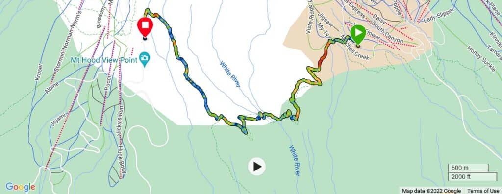
Fresh legs and the excitement of finishing the trail today were exhilarating feelings. Now we approach White River, a good size river with glacial melt swiftly moving down the mountain. Now the fresh legs and excitement have drained, for me personally, that is.
What made it a little difficult this year is we had to travel further off the trail in order to find an area that was easily crossable. The river cuts into the soft sand/silt and creates steep walls that easily break away.
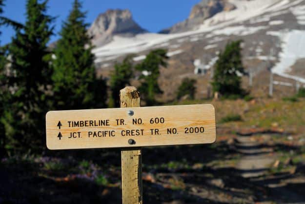
Eventually, we find a safe spot to hippity-hop from rock to rock across to the other side. Now a big ascent back up the other side of White River Canyon Through this section of the Timberline Trail is where the Pacific Crest Trail joins the Timberline Trail. We have done this section of the trail before when hiking from Frog Lake to Timberline Lodge, so we knew what was coming up.
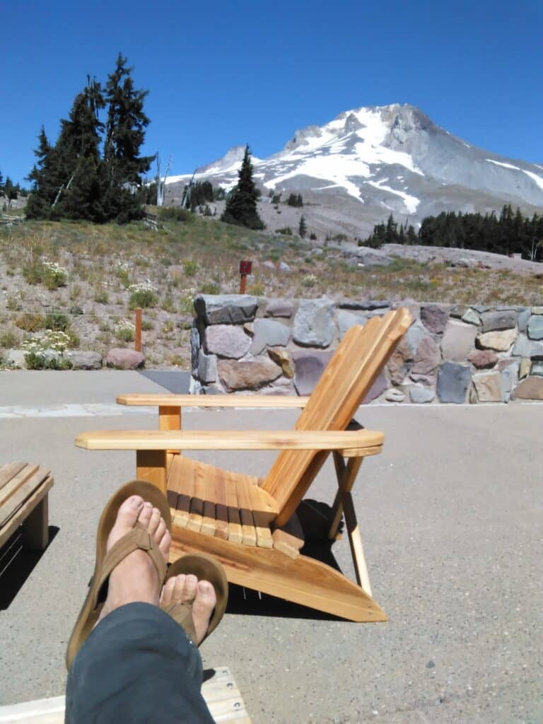
For the last time we climb above the tree line and are hiking straight up the ridge, but this time we are able to gaze upon the mighty Timberline Lodge. Now the adrenaline kicks in one last time even though every step seems to be slower than the previous.
There is one part of this section your heart starts to sink a little because you are now hiking up above and away from the lodge, no worries though, as it is to get above the steeper walls of the Salmon River Canyon, and this river crossing is just a small hop across the water, pretty simple even with a large backpack strapped to you.
Now I’m walking down the Timberline Trail towards the lodge, and start to get emotional, although I’m going with sweat running down my forehead. After five days and four nights on the Timberline Trail, it was a very gratifying feeling to be done. Oh my goodness we are done! High fives, fist bumps, etc.
We finished the hike earlier than we planned, due to being so close to the lodge in the morning, so the rooms were not ready yet. No problem, we lounged around on the back patio drinking a lot of water and adult beverages for some and more water. water, water, water, it never tasted so good.
My next goal for the day, hard to believe I had any more goals for the day, but this one was very important to me and the rest of the group. I needed a shower and a long wonderful shower it was, five days and 45+ miles of dust, dirt, and bugs, were all washed away.
Day 5 Stats:
- Miles = 4.08
- Total Ascent = 1,296′
- Total Descent = 1,089′
- Min Elevation = 4,879′
- Max Elevation = 6,009′
Need to Know Stuff
I mentioned earlier you’ll need a permit to hike the Timberline Trail and they are free. For parking, really anywhere around the mountain or trailhead, you should get a Northwest Forest Pass and make sure you leave it on your dash or hanging from the rearview mirror.
Be prepared for multiple challenging fords, there are several glaciers on Mt Hood, these are feeding glacial streams and at certain times of the year can be moving a lot of water down the mountain.
This is the wilderness, there are black bears in this wilderness. Now we’ve only come across one on the trail, not the Timberline Trail, and it wanted nothing to do with us. We are always carrying bear spray, each person in your group should have their own can of bear spray. Be prepared for the area, elevations vary on this hike so day and night temperatures can vary. Pack accordingly.
Past Blogs
Essential Guide to First-Aid Kits
If one of your goals is to hike the Timberline Trail but you have not backpacked before, read the following post and get a few outings under your belt.
A Beginners Guide to Backpacking
7 Principles of Leave No Trace
Extra Stuff
AllTrails App – check the most recent trail reviews
Forest Service – check for trail closures