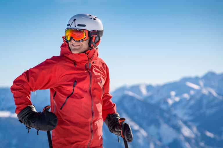
Best Backpacking Trail in The Eagle Cap Wilderness
What is the History of Eagle Cap Wilderness?
Tucked away in Northeast Oregon, lies the Eagle Cap Wilderness within the Wallowa-Whitman National Forest in the Wallowa Mountains of Northeastern Oregon. Encompassing around 359,446 acres of pristine wilderness, making it Oregon’s largest wilderness area, thanks in part to the Wilderness Act of 1964.
Not very many Oregonians even know Eagle Cap exists in the state. However, with it being little known it is still a popular hiking destination. Eagle Cap Wilderness got its name from what was once thought the tallest peak, Eagle Cap at 9,572, however, it was later determined Sacajawea Peak is the tallest at 9,838.
All the way back to 1400 A.D. the ancestors of the Nez Perce Indian Tribe first called this home it was used for hunting grounds along with gathering berries. And was the summer home for the Joseph Band of the Nez Perce Tribe, then in 1860, the first settlers moved into the Wallowa Valley.
In celebration of Chief Joseph, in Joseph, Oregon every year at the end of July, they have Chief Joseph Days there is fun for the whole family and if your little ones are brave enough, enter them in the sheep rodeo, it is a spectacle to watch.
How Big is the Eagle Cap Trail System?
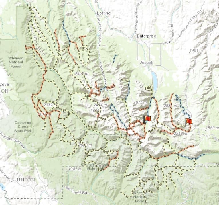
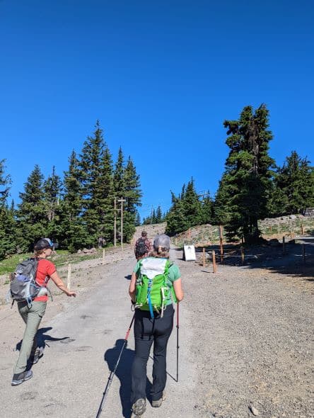
In the Eagle Cap Wilderness, there is a pretty extensive trail system, approximately 535 miles of trails, so there is plenty of trails to get your fill. However, our favorite trailhead to depart from is Two Pan out of Lostine.
This trailhead takes a bit to get to with a lot of the road being gravel, but from what we’ve witnessed it equates to less traffic. This particular trailhead also accommodates horseback riders. We’ve seen trailers in the parking lot, but have never come across them on the trails.
There is a lot to see in the Eagle Cap Wilderness here I would not be able to do the entire area justice here, so I’ll cover a small portion of what we have personally experienced, plus some other facts sprinkled in here and there.
What Wildlife is in The Eagle Cap Wilderness?
Many animals call this area home, from mountain goats, black bears, Rocky Mountain Bighorn Sheep, pika, pine martins, and even wolves. Deer, elk, and a few wolverines, then there are all the birds, Golden Eagles, Bald Eagles, Peregrine Falcons. Even Moose have started to call this area home, although I have not witnessed it for myself.
And there is plenty to eat for all of them here, from the lower elevation grasslands to forests and alpine meadows. It is a true sight to see these animals in their natural habitat and with the help of the National Wilderness Preservation System, it’ll remain this way for many future generations.
How to Access the Two Pan Trailhead?
Two Pan is East of Lostine, Oregon about 18 miles out of town on Upper Lostine Road. This road is paved for a decent portion of the drive but does eventually turn into gravel and when we’ve been there, it’s been a lot of washboard areas.
During parts of the year, even this trail will get busy and the parking can overflow. The best times would be June to October, but in June there still might be some snow so be sure to read trail reports from your AllTrails app or the Forest Service updates.
Make sure you bring along your Northwest Forest Pass for parking or you will likely receive a citation. The second best thing about this trail is dogs are allowed! However, if you do take your dog, be sure to clean up after them, please, I beg you, especially when it is left in the middle of the trail.
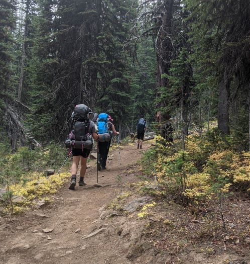
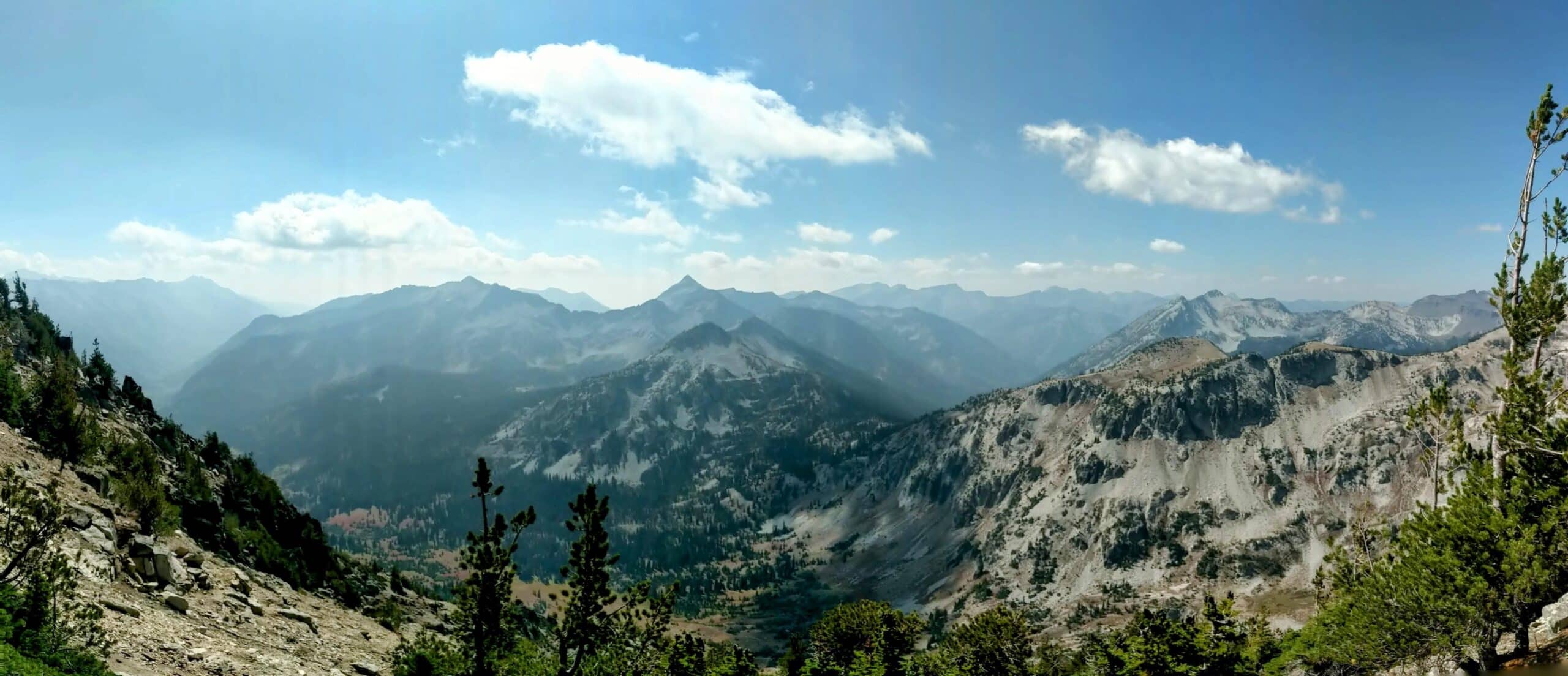
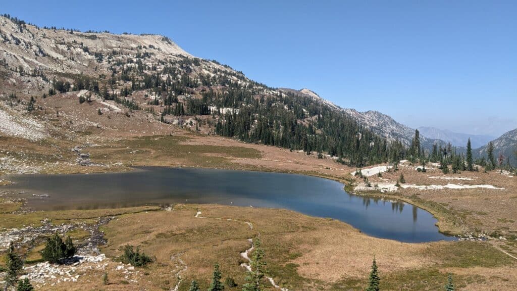
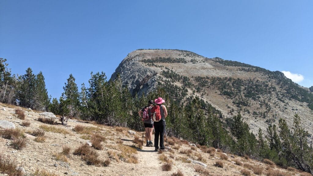
To get up into the Lakes Basin Loop area you’ll venture along the East Lostine River Trail, this trail will also get you to the base of Eagle Cap Summit Trail. The trailhead is about 5,512′ in elevation and the first 2.6 miles are a steady climb in elevation up to 7,093′.
This is where it will level out for a bit as you stroll along through alpine meadows and the meandering East Lostine River and you’ll start to see views of Eagle Cap Peak.
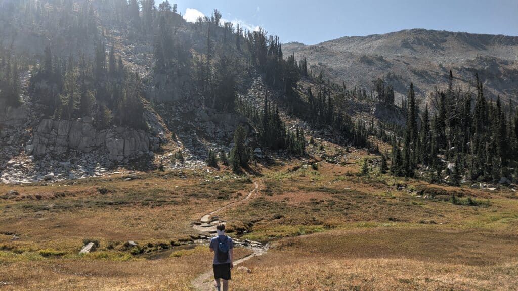
A second incline starts around 4.9 miles, here you only climb about 500′ in a little over a mile. And of course, if you are a hardcore hiker you can make the entire East Lostine River Trail and summiting Eagle Cap into a day hike I would suggest an early start and it is not your first time doing the trail.
We prefer to hike the entire way into Mirror Lake and establish a base camp and make several day hikes hikes from there, no sense in wasting time unpacking and packing all the time. Since once you get up into the lakes basin you’ll have access to a lot of additional trails.
To change things up a bit you can hike out the Ivan Carper Trail that’ll take you up and over Ivan Carper Pass. Once on the other side of the pass, you’ll have a great view of Minam Lake, and down closer to the lake, take the Minam Lake Trail out to Two Pan Trailhead. It is a longer hike out than it was in, but the different views will not disappoint you.
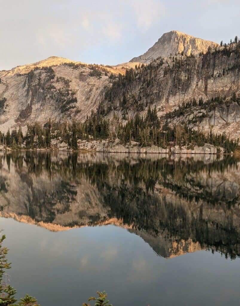
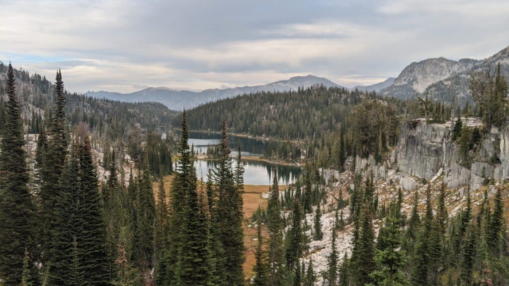
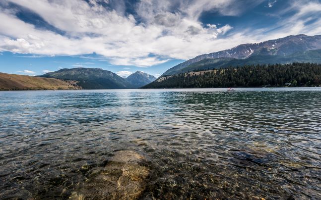
Lake Basin Area
Once up there you have easy access to many high alpine lakes and all the trails around there. Some of them are the beautiful Mirror Lake, Upper Lake, Linda Lake, Sunshine Lake, Moccasin Lake, Glacier Lake, Douglas Lake, Horseshoe Lake, Ice Lake, and Pocket Lake.
Several of these are pretty small but seeing them in front of you is way better than seeing them in photos. The Lake Basin Trail is going to be the major trail through here, but you also have Moccasin Trail, Horseshoe Trail, and Glacier Lake Trail taking you up and over Glacier Pass.
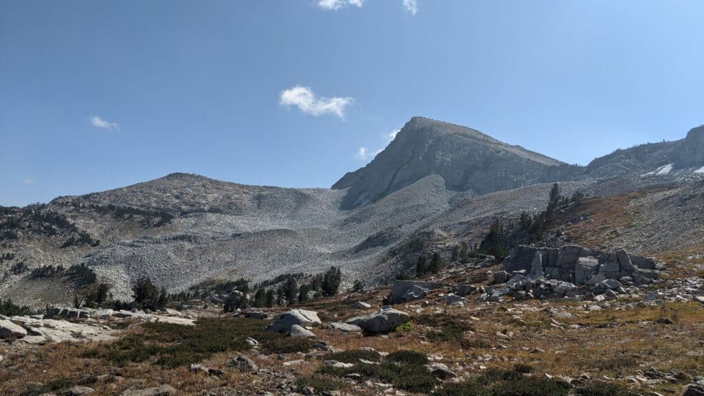
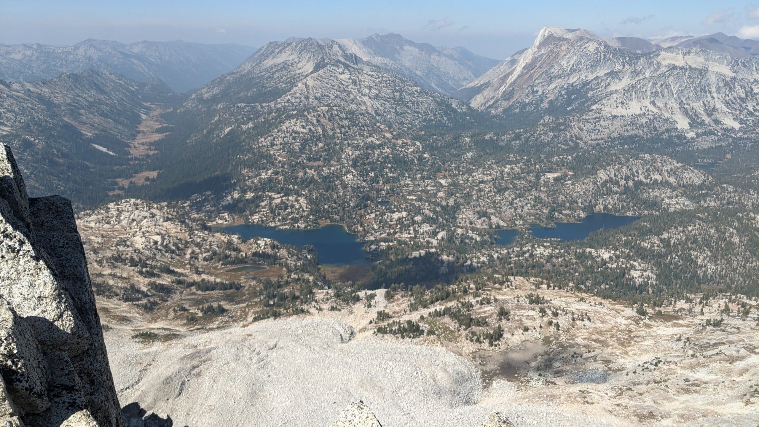
Summiting Eagle Cap
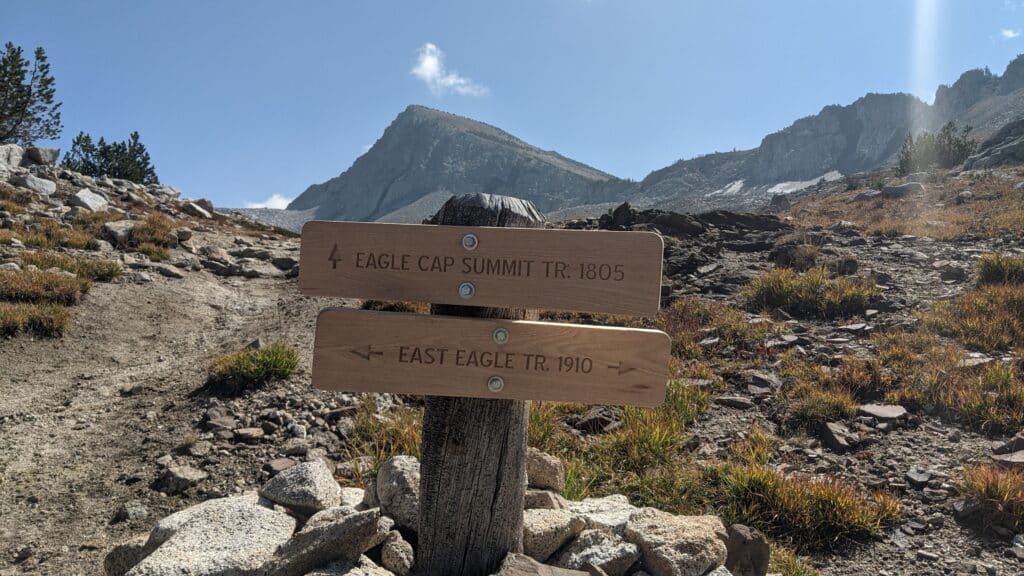
You can access the trail to the summit from the East Lostine River Trail, the trail junction is just a short walk back towards Two Pan Trailhead. From there it is a 6.8 round trip and about 1,933′ in elevation.
There are no water resources once you get above Upper Lake, so be sure to fill up before the climb starts in the river along the trail. There are many sections of this trail that are exposed to the elements, so be prepared for weather changes and use your sunscreen.
You’ll come to another trail junction, this is where the Eagle Cap Summit Trail begins. Or you can continue on East Eagle Trail to Horton Pass where there is another junction and it’ll get you back onto the Eagle Cap Summit Trail.
You’ll continue to zigzag your way up the mountain along ridges and across meadows, after a couple of longer switchbacks, you are getting close to the peak.
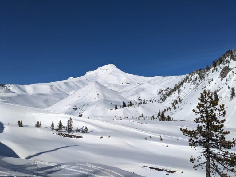
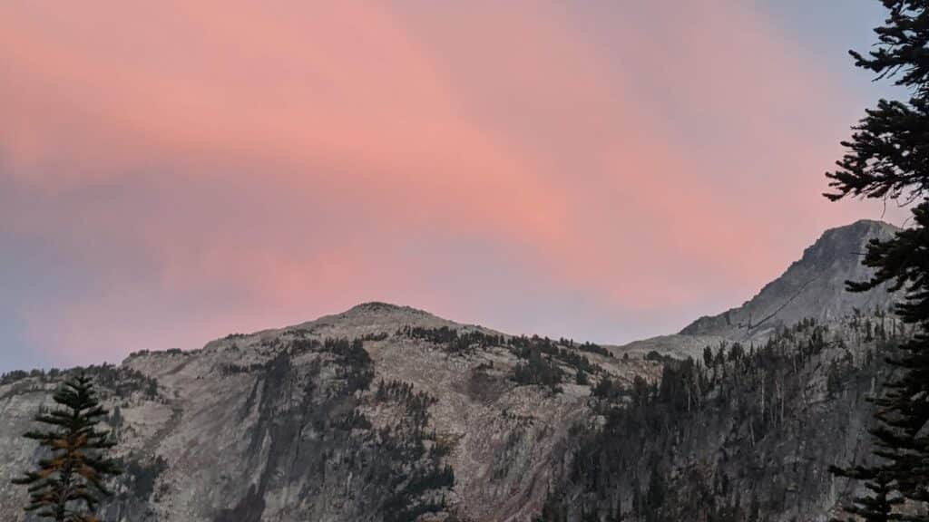
Now that you have reached the summit of Eagle Cap you are rewarded with views that are nothing less than spectacular. With a 360deg view, you can take in the many other peaks, alpine lakes, meadows, bare granite peaks, and Six Mile Meadow. The only thing to do now is to figure out which trail to hike tomorrow?
Things to do When Done Backpacking
After a short drive to Enterprise, you can get your fill of beer and grub at Terminal Gravity Brewery & Pub (just make sure you have a designated driver please). Then head over to Joseph and walk down Wallowa Lake Hwy and check out the rustic-looking buildings, art galleries, other eateries, etc. Now it is time to relax.
Head East out of Joseph towards Wallowa Lake State Park and dip your toes, feet, or whole body in the cooling glacier-fed waters. If you plan far enough in advance you can book a stay at the campground there at the lake or in one of the hotels. This area is a great place to relax, and rejuvenate for the drive home.
If you are going to be camping at the lake, another trailhead suggestion is the Wallowa Lake Trailhead, which will take you up the West Fork Wallowa Trail up into the Lake Basin area. This is a very busy trailhead though, so if you want more solitude while hiking, I would suggest Two Pan, then drive to Wallowa Lake when done.
Conclusion
The Eagle Cap Wilderness truly is the heart of the Wallowa Mountains, if not the entire state. We enjoy this area every time we visit, even through rain and lightning storms, it is still a beautiful and precious area to be seen. There is so much to be seen up here that it would take many backpacking trips in order to see it all and enjoy it thoroughly.
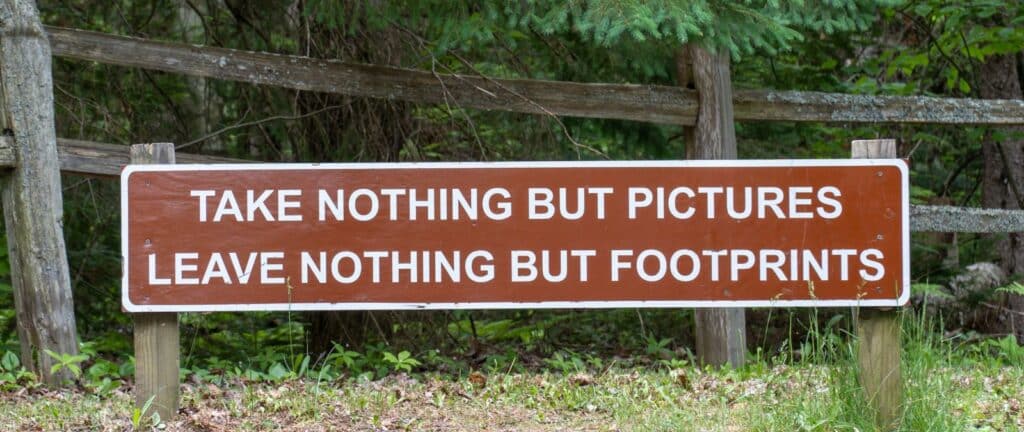
If you make this hike one of your must-do trips I only ask that you practice the 7 Rules of Leave No Trace. If you take your dog, please pick up after them. And most importantly be safe and have fun! If you are looking to get into backpacking check out our post here to get you started, A Beginners Guide to Backpacking.
Additional Trail Heads
Courtesy of The Forest Service
Accessed from the Lostine and Enterprise:
- Bowman-Francis Lake Trailhead
- Maxwell Lake Trailhead
- Hurricane Creek Trailhead
- Wallowa Lake Trailhead
- Tenderfoot/Big Sheep Creek Trailhead
- Indian Crossing Trailhead
Accessed from the La Grande:
Accessed from the Halfway: