Mount St. Helens: Spectacular and Endless Views
If you are a Pacific Northwest hiker like we are then you most likely have a goal of summiting Mount St. Helens. It is one of those quintessential hikes we all want to do. During the summer months and once a lot of the snow has melted away, you can hike up an established trail. July 30th was to be our day to make the summit for our first time.
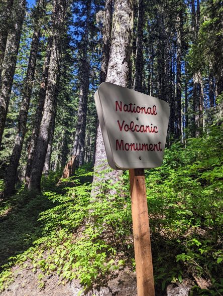
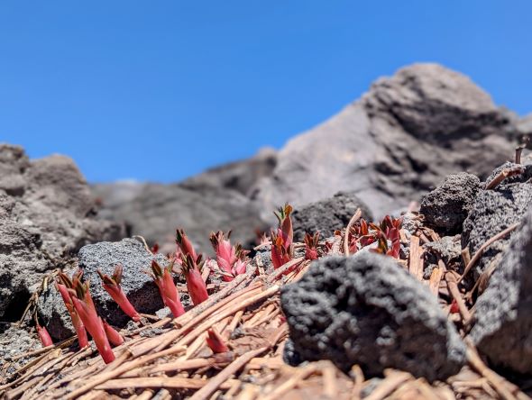
Mount St. Helens is an active volcano in Washington State. Its volcanic eruption occurred on May 18, 1980, and devastated the area, a very large area, to date it is the most destructive disaster in US history and obviously changed the landscape permanently.
Permit Stuff
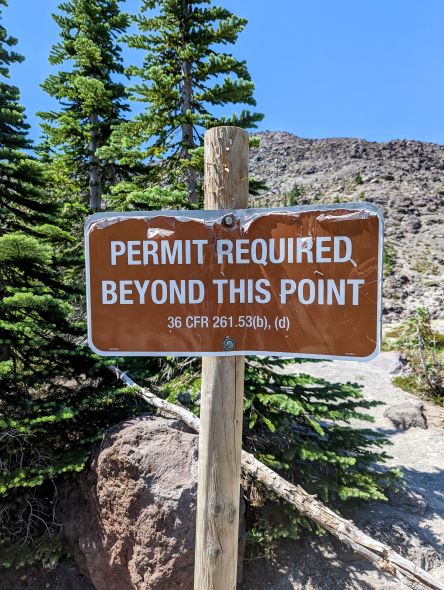
We were lucky enough to obtain a climber’s permit for Mount St. Helens in the popular season. The permit issuing process works through an online reservation system and starts at 7 am Pacific Time, and permits are only released in one-month increments on the first day of the preceding month.
It can be rather difficult to get since there are a lot of people trying for the same days and they only issue so many permits for a given day, 110 people in total (May 15th – October 31st), and each permit allows up to 12 hikers. So we had our 12 people listed on the permit and it was time to start training. The permit could be easier to obtain if your group size is not so large.
Training
Our plan was to hike some of the steeper and more challenging trails around the Portland area. We were able to get a handful of good hikes in, but we had planned for several more. As it turns out two of us, plus a third person in our group got covid, so we were down for about 10 days just before the planned summiting day.
So, if you think this hike is too hard for you, just remember, that three of us did it directly after getting over covid. Anything is possible if you put your mind to it.
Check the Most Recent Trail Reports
We were keeping tabs on the trail reports through AllTrails and the Forest Service, which would help dictate what gear we planned on taking with us. Fortunately, the snow had melted for the entire ascent, so we did not need spikes or crampons.
Several of us did not plan on doing any glissading down the mountain, so we did not pack an ice axe either, or other equipment to sit on. So, for the typical hiking pack items, you can check out our list here, as well as essential first aid kit items here.
The weather for the day called for HOT, all day, so no raingear needed. However, with this hot weather, we needed to be carrying more water. Most of us carried about 6 liters of water and most of us consumed most of it.
For hot weather climbing, I cannot stress enough, to pack extra water. Trekking poles are another good addition, really help the knees in your descent. If you are leaving early morning, a head lamp is a must.
Technical Stuff
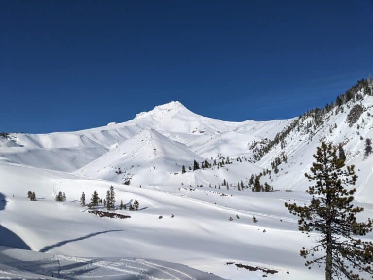
Some stats on the mountain. Mount St. Helens peak reaches 8,362′ and the Climbers Bivouac Trailhead is at 3,678′ so the vertical feet is 4,684′. The feet of elevation gain for us was 4,649 and our total miles was 9.2, to the true summit up the Ptarmigan Trail crossing the Loowit Trail and I guess part of the trail is along the Monitor Ridge route.
There is another trail, Worm Flows, but it is more of a direct winter route I guess. We arrived at the trailhead at about 4 am and there was still a lot of parking available.
We hit the trail with all our head lamps lit up at 4:30 am and it was dark. In hindsight, we should have started even earlier, next time. Depending on how long you spend up at the top, which we spent a fair amount of time, you can get it done in 8 hours or more, round trip.
Depending on the time of year you get your permit you may look at an early start to beat the heat. Through the second and third sections, there is no shade, you are fully exposed to the sun. This trail is a non-technical climb so technical climbing skills are not required, but being in good physical condition is helpful.
Accommodations and Directions
We stayed the weekend in Cougar, at the Cougar RV and Campground, it was a nice place and convenient for us. There is another RV park in town plus a campground not far from Cougar.
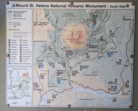
We drove east on Hwy 503 and turned up forest road 83, passing Ape Cave (not Ape Caves), then veering onto FS-81 and lastly a right onto 830-Rd. There are signs the entire way up there, so getting lost would be pretty hard to do.
Make sure you have your Northwest Forest Pass or you’ll have to pay $5 for the day for the parking lot.
Let’s Do This
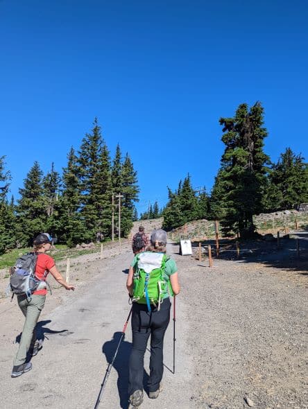
The hike begins. Hitting the trail at 4:30 am is really early, which meant we were up at 3 am. That is a little brutal, but in order to try and beat the heat, it is what we had to do. For the first couple miles (aka the first section) in the trees, the trail is nice and dusty, but solid.
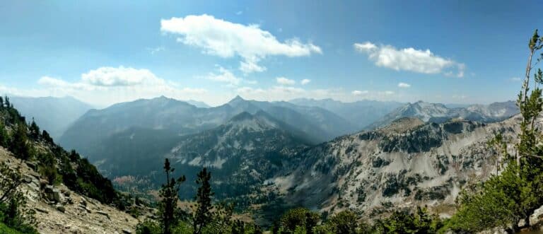
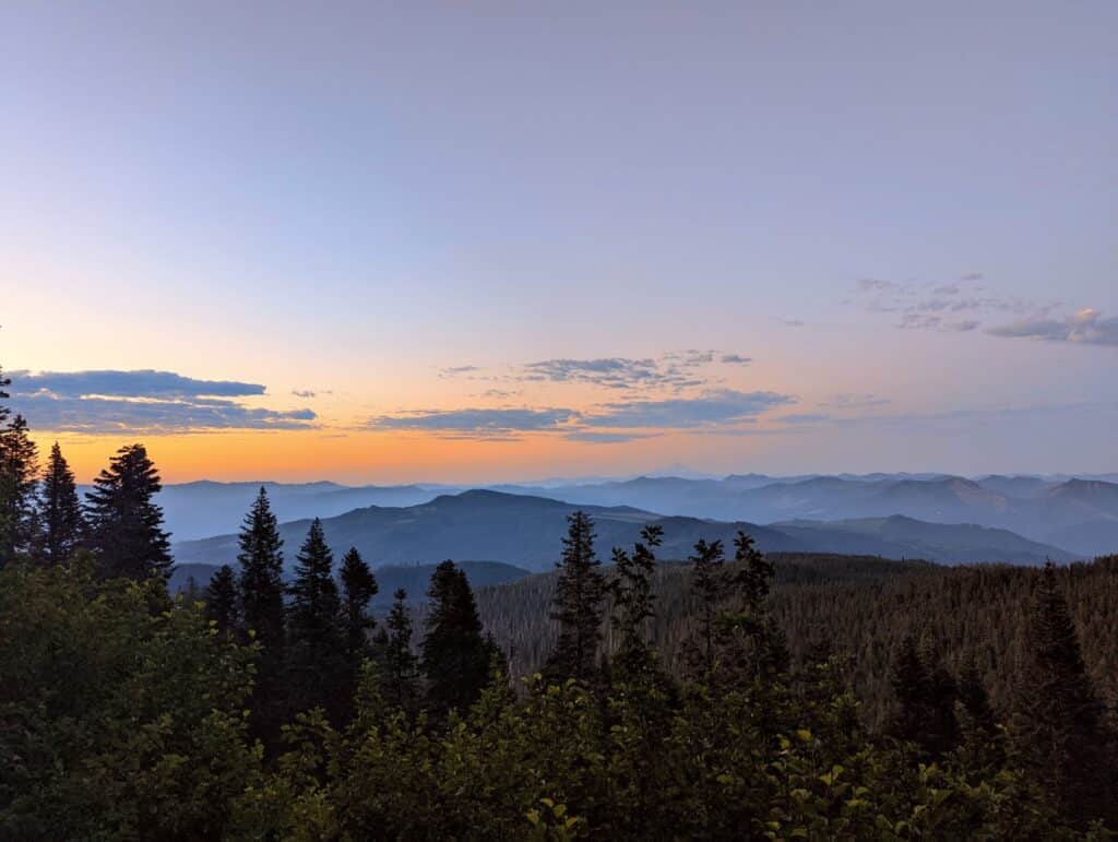
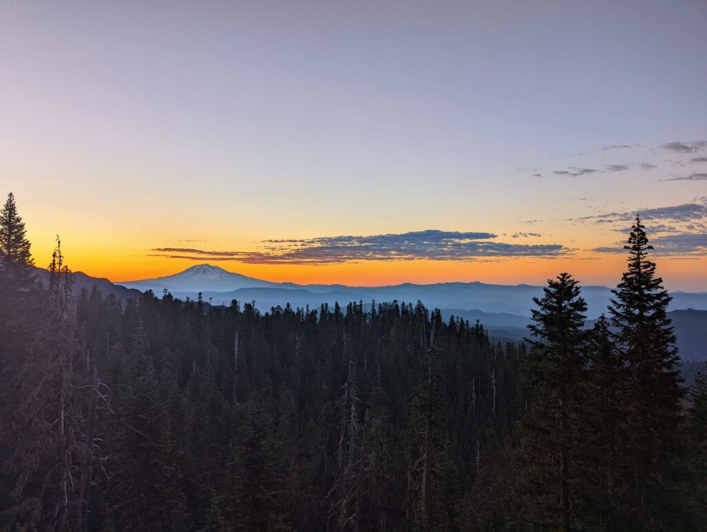
For most of the morning, it was pretty dark, but there were a few stretches that gave us a front-row view of Mount Hood, after a couple of corners another great view, this time of Mount Adams.
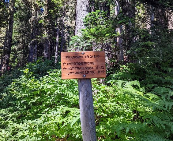
It was getting more light out when we arrived at the Loowit Trail intersection. This is where our first break took place, and we enjoyed it. After leaving the intersection there is only a short distance until the more rugged terrain begins, or the boulder section (aka second section).
This first section is like any other typical day hike and would be a pretty good one if you did not have a permit for hiking up to the summit of Mount Saint Helens. You’ll get a great view of Mount Hood and a view of Mount Adams plus all the other scenery.
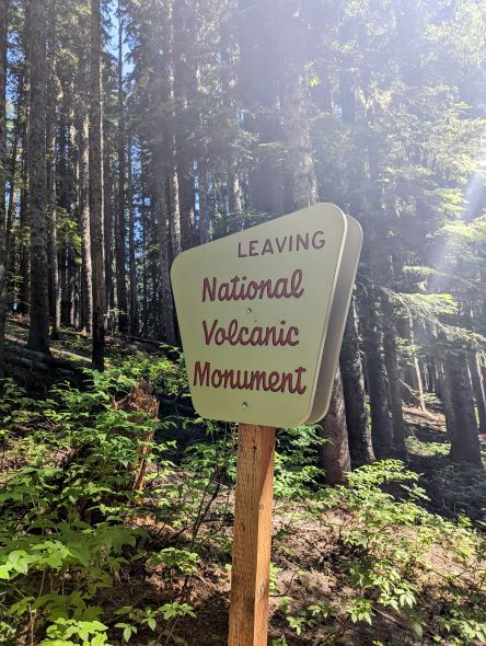
It is still pretty early at this time so what sun there was it was not warming up much yet when we exited the tree line, which was good. This is also where you have to have a climbing permit to continue up the mountain.
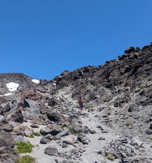
The boulder field is interesting, to say the least, it is a big mix of smaller boulders, larger boulders, and much larger boulders, where oftentimes there is a gravel trail/paths in between these jungle gym-like structures.
This section is where your gaiters will come in handy. Along with the many different boulder sizes, there is also a lot of gravel and pebbles, the kind that likes to jump up and get into the top of your boots or shoes.
You know the ones, the ones where you notice it and keep walking for a while thinking it will shift and you won’t feel it anymore and finally have to stop before it drives you crazier (or is that just me?).
So, gaiters are nice here and for the rest of the hike up. This boulder section is also where wooden poles or wooden posts will mark the trail for the most part, but you’ll notice there seem to be many paths going up. Some people just take another route, so you just have to choose the one you think is best.
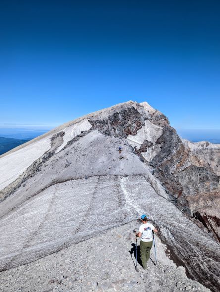
This boulder field seems to just keep going and going and has many what I would call false summits. Where it looks like you’re getting to the top of the rock pile, only to find out that once you crest it, it keeps going up and up.
This goes on for about 1.5 miles, with the last part of this section being the most scrambling you’ll be doing.
A lot of people were recommending garden gloves or some other type of gloves for the boulder section, I did not use mine, I used my trekking poles for 99% of the bouldering. Very few times did I actually need to use my hands to climb up, this was the same for the descent.
The great news is once you arrive at the solar panel-powered monitoring station, you are almost done with the boulders.
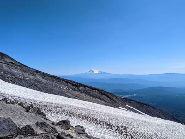
Now that we get above the boulder field, we have the third and last section of trail to climb, this is another good place for a break. This is another point where you have incredible views of Mount Adams.
The higher you get up Mount St. Helens the larger Mount Adams seems to be. The last half mile of the trail is like a big ash field and it’s steep. It’s a mixture of ash pumice, volcanic ash, pebbles, small rocks, and everything in between.
You’ll take one step and slide back a half of a step, so it takes a little bit to get up this steeper section. Through here we noticed a lot of different ways to get up to the top, again, we just had to choose the best path for us.
Plus, if you chose a different route chances were you did not have to deal with a hiker coming back down.
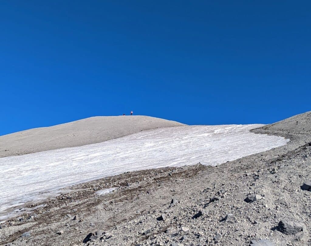
I’m not going to lie, but this section is hard work, first because of the ground composition and secondly, the mental strain. For this last 1/2 mile, you can see the summit the entire time and it just seems like you are not getting any closer. However, once you get closer to the top, your adrenalin starts to kick in, and becomes an easy hike (in the head only) to the top.
Summiting Success
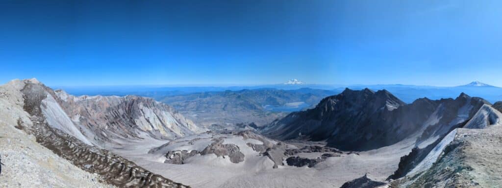
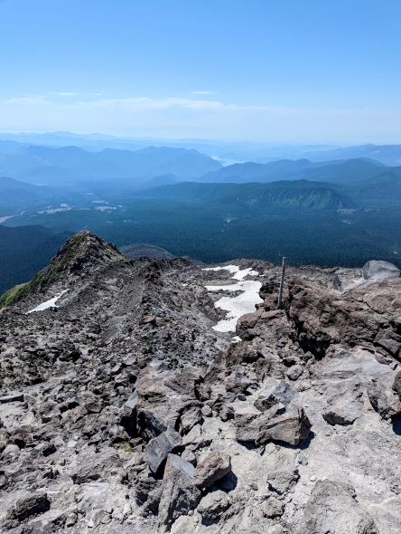
You crest over the top and approach the crater rim and you are just awestruck with the views. News Flash! we’re not at the summit yet… that is another 15 minutes along the rim to the west to reach the true summit.
We were a little mixed about whether it was worth it or not, however, if you hiked the entire way up here why would you not go the extra few minutes to reach the real summit, so three of us set out for the true summit. Our mistake was, that we dropped the packs and trekked over there without any water. Could have used a drink or two along the way.
After some photos to cement the achievement, we headed back to the rest of the group. Now it was time to sit down, chill, and enjoy an awesome sandwich and good company. We chatted with fellow hikers and talked about sections of the trail. When we were up there, there happen to be a couple that was going to be married up here.
They had a small group of friends and one was ordained to perform the ceremony, pretty cool idea. We continued to rest, getting up to take additional pictures or stretch and tidy everything up in the pack.
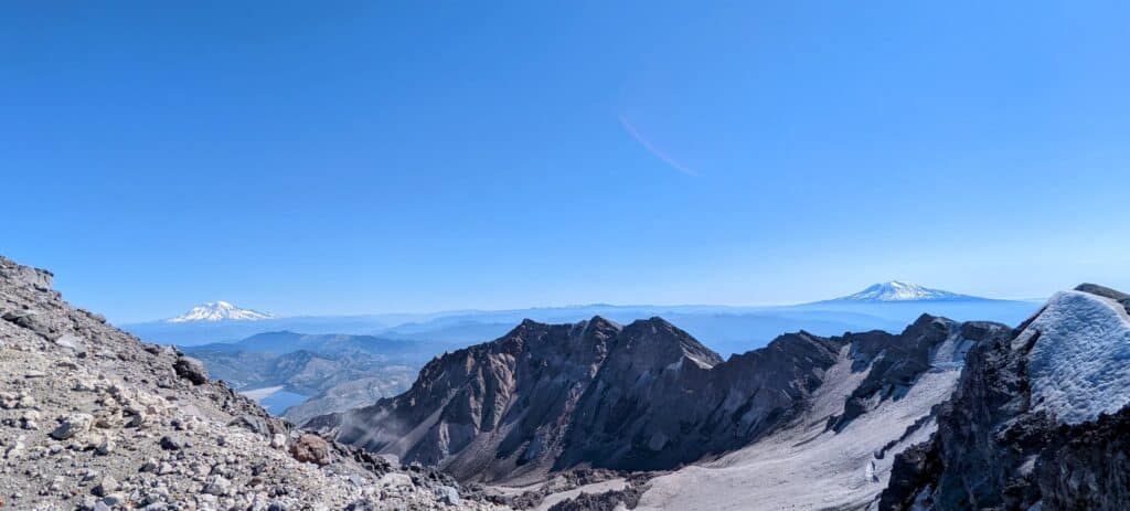
From the top of Mount St. Helens, you have an up-close and personal view of the crater and how massive it is. And seeing the lava dome that about five years ago or so was growing rapidly and many thought it was going to be erupting again, thankfully it has not. You also have an amazing view of Mount Rainier, Spirit Lake, and to the north, east, south, and west, just amazing!
These views are obviously best on clear days, but this is the Northwest, we never really know what the day will be like until after it has happened. Another incredible but devastating view is the lava flow and how it just puked from the mountain and ran down the hillside covering everything and leaving nothing behind.
The amount of material that flowed from the crater is hard to fathom. Mount St. Helens was originally 9,677′, now it is 8.362, so that is a lot of mountain debris to just flow down.

Side note: I grew up south of Portland by an hour or so, and was around when it blew in 1980. We happened to live on a hill and had a pretty good view of Mount St Helens. It erupted at 8:32 am on a Sunday and we could see the eruption standing on our back deck, and the plume this thing was emitting was scary, especially as a younger kid.
Later in the late morning or early afternoon maybe even the next day, I do not quite remember the time but there was ash falling on us and it started to pile up. I recall for a long time after it happened it was all everyone talked about. It devastated the area from the loss of human life, wildlife, nature, and the local economy.
Time to Descend
Now it was time to discuss how we were getting back down the mountain. Since we did not have the proper equipment to glissade back down, I assumed we were walking back down. But watching a couple of other guys cruise down the mountain with minimal equipment, I thought I would give it a try and see how it went.
A few in our group decided they would slide down on their feet, which worked okay, but after a couple of spills, I tried something else. We had some gallon baggies we thought we’d try, it worked okay but was not ideal.
So I ditched the baggie and went with the seat of my pants, nothing between the snow/ice and my bum. This was the best option and I’m glad I did, it was an easy and super fun way to get down the mountain about 1,100′.
There were a couple of hairy sections but for the most part, it was the way to go. There started to be more and more boulders in the snowfield, so I decided it was time to bail out and get back over to the trail.
I chose my stopping point and it happen to be a boulder the size of a medicine ball where I came to a halt. I waited to see if anyone else in my party chose to come down the same way and after a few minutes one person crested over the hill, having a blast too I will add.
The rest of the folks bailed out a little further up the hill, so they’d be walking down and we had to wait for them. We happen to be down to about the start of the boulder scrambling field.
Time to Descend on Foot
The group started to join back up and a few of them took off, but I waited for my climbing buddy (my wife) and took in the wonderful views, I just could not get enough of the views. Once we were back together, it was time to start the process of climbing down.
Getting through the boulder section is, I think, worse when descending. Mainly because it is harder on the knees. This is where trekking poles come in super handy, it is still a lot of stress on the knees but is greatly reduced with poles.
In only a few different areas where the drop-down was greater than what I thought my poles would work, I used my hands, but still, no gloves were needed. It seemed like this section would never end and you just cannot wait until the tree line to get some shade, the sun at this point is straight above and the heat is just beating down on us.
There are some very large boulders here and there that you can sit down behind to catch some shade, but really, I just wanted to keep moving. Once the tree line comes into view, you get that good old adrenalin rush back.
Finally Back in the Trees
Now the shade hits your back, you take your hat off and your head cools off a bit, chugging a bunch of water knowing you only have a couple more miles to go. Now’s when you find another gear and your pace picks up quite a bit, plus the ground is nice and solid again.
You have this rush going and you’re cruising along pretty well since you know the trailhead is not far away, but these were the two longest miles I’ve ever walked in my life.
The funny thing is, all this is new since it was pitch black when we started. So, this is all new scenery and you do not get that feeling of knowing you are getting close, because you do not recognize anything, since this was our first time hiking this trail.
There was one section I do vividly remember because it was several man-made steps in the trail and they were at the very beginning of the trail, I knew we were home free!
Let’s Wrap This Up
The first comment I made when we got back to the car and saw everyone else, was “boy am I glad to be done and I don’t think I need to ever do it again”. Now a few days later, I’ve rethought my position on the whole excursion and I think I will do it again for sure.
This time I would definitely like to leave even earlier and try to summit before sunrise, for some epic photos. And to beat the heat!