Sailing the Multnomah Channel: A Serene Sailing Journey
Have you ever considered embarking on a leisurely sailing expedition along the serene Multnomah Channel, tracing the picturesque landscapes of Sauvie Island? Join us on our immersive journey as we share our experiences, from encountering Fred’s Marina, admiring the Sauvie Island Bridge, and exploring the scenic beauty of Scappoose Bay (if able).
Take a captivating hike around Coon Island and a delightful stroll through the charming streets of St. Helens. Whether you’re eager to live vicariously through our adventure or set sail on your own to create lasting memories, the mode of travel is yours to choose—sailing or power boating; both promise a unique connection with nature’s wonders.
Embrace the unhurried pace and relish the boundless treasures nature has in store for you.
A little History
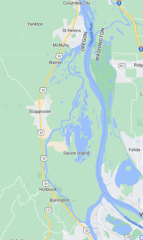
The Multnomah Channel flows between Hwy 30 and Sauvie Island, moving northwest of Portland, Or. The Multnomah Channel branches off the Willamette River, just up from Willamette’s confluence with the Columbia River. It flows about 22 miles before joining the Columbia River near St. Helens.
Throughout the channel’s history, it has been adorned with several names. The original name by its inhabitants, the Chinook People, and the Multnomahs, was Wappato Inlet, and Sauvie Island was Wappato Island. This was also the name used by Lewis and Clark in the 19th century.
Before them was the first European explorer to discover the channel. He named it Calls River in 1792. A nautical surveyor named it Warrior Branch because it met the Columbia River at Warrior Rock. Then at some point, it became known as Willamette Slough. Then in 1913, the United States Board on Geographic Names (a mouthful) changed it to Multnomah Channel.
And We’re Off
We were again going to depart from Hayden Island, so we’d deal with the Interstate Bridge and the Burlington Railroad Bridge. However, upon entering the Columbia River from our marina, we could see the bridge was swung open already.
I quickly called the bridge operator to inquire how long the bridge would be open, and he stated about 15 minutes.
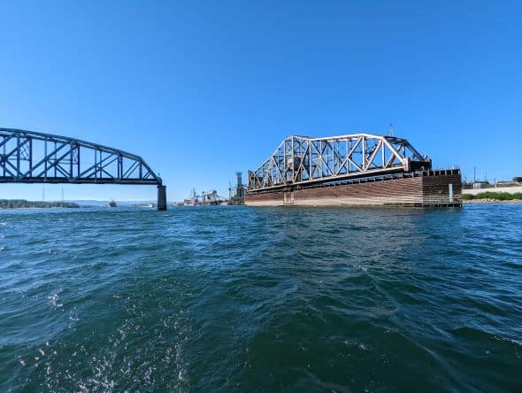
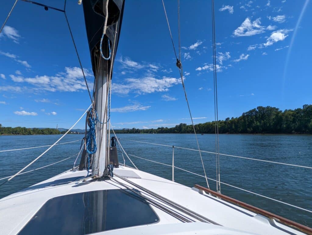
It was time to haul butt. When I say haul butt, remember this is a sailboat, so hauling butt is about 7knts (8mph), not very fast. Thankfully this speed was enough, and we made it in about 12 minutes. Once past the bridge, it was time to throttle down and enjoy the cruise, motoring, not sailing.
This is not the first trip we’ve made along the Multnomah Channel. A couple of years ago, we traveled the channel from St. Helens south to Coon Island (hereafter known as JJ Collins Memorial Park). This time we wanted to make the trip headed down the channel.
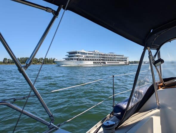
However, we’d have to motor the entire way since the winds are typically not in our favor. Now while we are still in the Columbia, off the Vancouver Port, we are dwarfed by large container ships, grain barges, and tugs, along with power boats zooming by us.
We eventually make it to the confluence of the Willamette River and turn up the river; otherwise, we’d end up sailing to Astoria. Now we have northern Portland on our left and Sauvie Island on our right. On this trip, this is a fairly quiet part of the Willamette River, with only a few boats passing in both directions.
This is the same area; a few years back, we heard an emergency call over the radio about a fire on a conveyor belt at one of the industrial businesses. The guy on the radio was adamant about it being a fire, but there happened to be a worker on the freighter receiving the load, and he could not see anything.
Then not long after, it was determined to be a metallic streamer wrapped around the conveyor belt, and the current state of the setting sun made it appear as if it was a fire. Oops.
The Multnomah Channel Begins
We round the corner to enter the channel. Here you’ll get a view of St. Johns Bridge and the Linnton area, and the current noticeably began to slow. I dropped the rpm’s to about 2k. This allowed us to cruise at 5knts. Not too fast, but fast enough to make it feel like we were making progress.
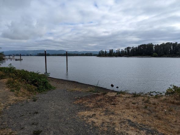
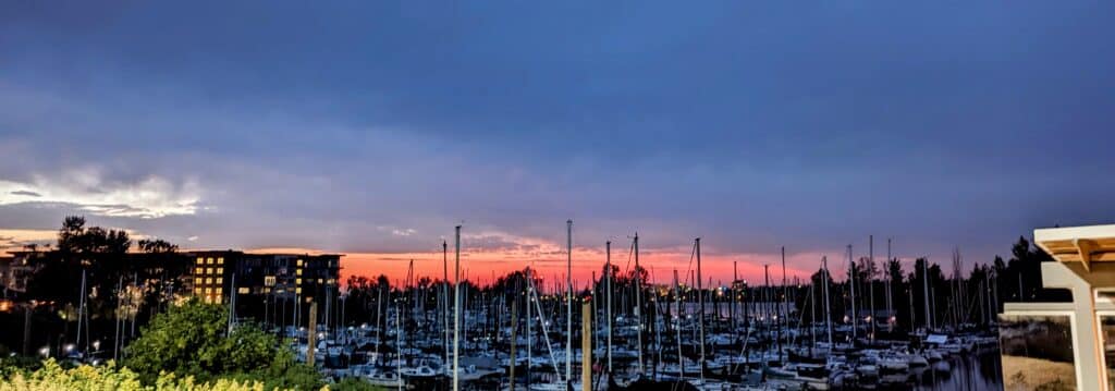
Along this first section of the channel are a marina, Fred’s Marina, and some houseboats on the left and a large dike on the right protecting Sauvie Island. Due to this dike, you cannot see much of what the island offers for a while. You cannot see most of the island past the shoreline, except for a few instances where inlets protrude into the island’s interior.
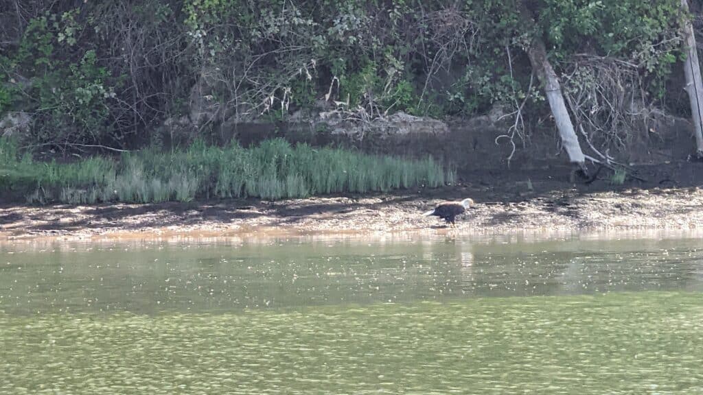
There is a lot of wildlife here, from fish jumping to birds chirping. We even saw a bald eagle feeding on a fish during this last trip. He looked up at us as we passed by, then returned to feasting. There is a lot of osprey through here, along with other birds we could hear but could not see as they were deeper in the trees over the dike.
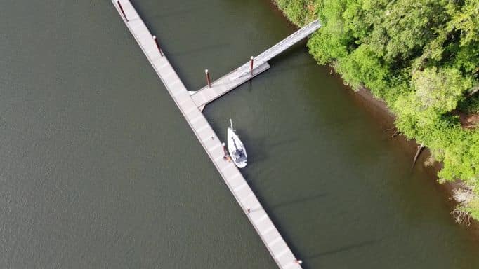
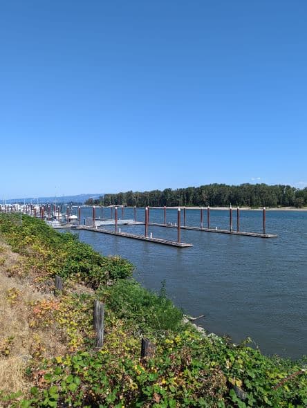
After a few corners past Fred’s Marina, there is Sauvie Island Moorage. Many houseboats and boathouses are here, as well as boat slips. There is a ramp here, too, if you have a trailerable boat. Hadley’s Landing is just past the boat ramp, a nice dock with plenty of room to tie up your boat for a small hike.
This landing accesses Wapato Access Greenway, a 170-acre park along Virginia Lake. There is a 2-mile trail, most of it paved, but there are a few dirt/gravel sections. Note: This dock is free; I believe there is a 72-hour stay limit.
After passing Hadley’s, you’ll see nothing but farmland and some rundown boats, boat houses, and other structures, a nice calm stretch of the channel. The next sign of civilization is Rocky Pointe.
From here, I think there are about five different marinas and moorages with many different styles of houseboats. Some are fairly traditional-looking houses, while others are fairly eclectic. Now the Scappoose area of houseboats starts with several moorages and interesting scenery. Some are really nice looking, while others make you wonder what they were thinking.
But to each their own.
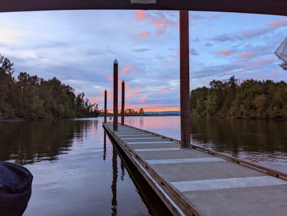
JJ Collins Memorial Park (aka Coon Island)
A few big bends later, JJ Collins Memorial Park comes into view. We’ve been here a few times by various means of transportation, but every time we tie up on the island’s east side. This is a much nicer dock, and the water is calmer.
Now, this is not to say the preferred side is always calm; it is not. You still have folks that apparently do not know how to read the no-wake buoys before and after the island on this side.
Tip: tie up on the inside of the dock up towards the gangway. It makes for a less rolling day and does not tie up at the end of the dock. It is the worst spot to be.
With that aside, the island has tent camping sites, a pavilion with a picnic table, and fire rings. There is also a restroom up there, one on the eastern shore and one on the island’s west side.
There is also a trail around the island, and as of this writing, they have recently been through here and cleaned up the trail. However, the mosquitoes were horrendous! If you keep walking fast, you might be okay, but be warned and prepared.
We ended up staying here for two nights. On both nights, only we and one other boat were at the dock for the night. A handful of boats would stop and use the restroom or get out and walk around a bit.
So, people-wise, it was very quiet, a nice peaceful weekend. Another thing of note here is cell service, at least for AT&T. Since we had cell service, we stuck around for the morning on Monday getting some computer work done.
We departed the island just after noon and headed down the channel towards St. Helens. Not too far down the river, there is an inlet. This inlet, Gilbert River, gives you access to Sturgeon Lake. Now, this is inlet is not for sailboats or anything deep-hulled.
Rather it is good for paddle boards, kayaks, and canoers. We kayaked up it several years ago. If you have a kayak or have access to a kayak, what am I thinking? You can even rent a kayak.
You can launch from Sauvie Island at the Gilbert Boat Ramp and overnight park here. Accessing the boat launch, you drive onto the island using the Sauvie Island bridge (see map here).
Be sure to remember your sunscreen, bug spray, binoculars, and your camera. For a more comprehensive kayaking write-up, see our previous post here.
With only five nautical miles, the river twists and turns along farmland, a few houses on the shore, and some may be derelict houseboats or boat houses. Tough to make that call. They are pretty run down and do not look like they’ve been inhabited for some time.
Through this area, I am always amazed by the depth here. On the inside of a corner, it is obviously going to be very shallow, and on the outside of the corner, the depths are upwards of 60 feet in some areas. And 60 feet within a very short distance from shore; hard to believe it drops off that fast.
Also, going through here, there is not much wind at all. Actually, this time, there was zero wind. So it can get pretty warm, but soon after, the channel opens up a bit, and the westerly winds will again be in your face.
One long straight stretch will get you to Mount St. Helens. You’ll also pass the entrance to Scappoose Bay; we have not been up there yet. The entrance on charts is about 6 feet, not a whole lot, and it has never worked out for us to be there during high tide, but we are looking forward to getting in there.
They have a guest dock to overnight at, and a Next Adventure Store is there. They are always fun to walk around in. But it was not in the cards for this trip either, so onward we went.
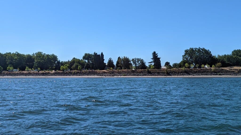
Soon after passing the entrance to Scappoose Bay, St. Helens and Sand Island come into view. Here you will stay to the left if you are staying at the St. Helens City Docks and to the right if you stay at the Sand Island docks.
The public docks in St. Helens recently started charging $15/night for moorage with a 72-hour limited stay. They also offer electricity for $5/night (it used to be $10/night). By charging a nightly fee, I guess they’ve reduced the riffraff on the dock.
This time there was only one boat that appeared to not be in service, and I’m sure they were not paying the nightly rate.
Ol’ St. Helens
What to do in St. Helens? St. Helens is divided into two parts, the Hwy 30 part, and the river part. The river part is more of the old-timey style. The courthouse is down there, and the police station.
But there are also several restaurants, bars, knick-knack stores, one grocery store making itself known, and even a small movie theater. There are restrooms up on shore in Columbia View Park.
In the park, during the summer, they hold Thursday night concerts, and there is also a decent size play structure if you are in need of one. It is about a mile’s walk, but you can get to Walmart and other stores on Hwy 30 if needed. Sorry, no taxi service or Uber here to get you around.
I recommend Molly’s for groceries and a meal if you stop here for a day or two. They also offer hot food, and it is good. The turkey cranberry sandwich is awesome! A few other places I’d recommend are Plymouth Pub, Running Dogs Brewery, and the Kozy Korner Restaurant for breakfast.
You can also check out the Columbia County Museum if it happens to be open while you are there. It only appears to be open on Thursdays from noon to four.
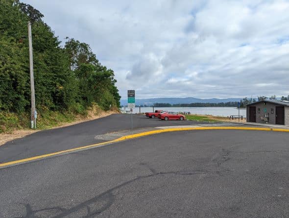
If you want to kayak or canoe around Sand Island, there is a great launch just north of the St. Helens Marina called Grey Cliffs Waterfront Park. There are a handful of parking spaces. However, the lot has a 15-minute parking limit for some reason.
There seems to be street parking, though. The walk down to the water is not steep; it is plenty wide enough to walk your boats down, and lots of room to prepare for launching.
Time To Head Home (figuratively speaking)
We hung out here for the full 72 hours before returning to our slip on Hayden Island. We chose to go the Columbia River route for our trip home as the day was calling for some good westerly winds.
Once we leave the channel between St. Helens and Sand Island, the current really begins to pick up, and our progress is slowed. But we can now hoist the sails and cut the engine.
Under sail power, it is just so much more peaceful, not getting anywhere too fast, but it is peaceful. The first cool sighting you’ll have here is Warrior Rock Lighthouse, a lighthouse steeped in local history. If you have a dinghy, you can easily get here from the docks in St. Helens, and there is a sandy beach to run it up on.
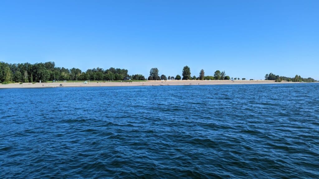
A little bit further up the river, you’ll see Collins Beach (clothing optional beach), and on the other side of a patch of trees is the more populated Reeder Beach (clothing required).
Over on the Washington Side, there is not much to be seen; it is mostly farmland. The only other place of note on Sauvie Island you’ll pass is Reeder Beach RV Park, our favorite.
If you are lucky enough to get a river view site, you can hang out on the dike sipping cold sparkling waters or adult beverage of your choice and watch the ships go by, or this time of year, a lot, and I mean a lot of fishing boats in the area, as it is the salmon fishing season right now.
After sailing for a while, we eventually came up on Frenchman’s Bar Regional Park, a popular beach for Washingtonians. Rounding the corner, you begin to enter the Vancouver Port again and be dwarfed by all the ships.
These shipping containers make a recreational boat seem very small. We needed to hail the bridge operator this time and ask for a bridge opening. He stated it would be about fifteen minutes as a train would be approaching.
So, we throttled down and just tried to stay in place while we waited. After the bridge, there is nothing more exciting going on. Cruising under the Interstate Bridge again, passing the Holiday Inn, Hayden Bay Marina, and then entering Tomahawk Bay and being treated to a fabulous view of Mount Hood.
The only thing left is to haul our stuff back to the van and plan our next sailing trip.
Conclusion
This is an easy weekend trip, we typically prefer to make it a three or four-day weekend and try to spend at least a couple of days at each place, but it does not always work out that way. In a power boat, one can easily do it on a regular weekend and be back home for supper Sunday night, but that is not our style.
Two fueling stops I can recommend on this route are Fred’s Marina and St. Helens Marina. Both have fuel and a small store.
As for free docks, the only ones will be Sand Island, JJ Collins Memorial Park, and Hadley’s Landing. While the St. Helens dock charges, they also offer electricity for a small fee making a one-night stay $20.
To make this a more enjoyable trip, be sure to check the weather conditions. High westerly winds and an outgoing tide make for whitecaps on the Columbia. Not too enjoyable if you ask me. Rain is not much fun, either.
Another thing to remember when scheduling your sailing or boating trips is to check the Cruise Schedule, some of the docks can get pretty crowded by a yacht club’s weekend cruise, but you still have every right to be there as they do.
Make St. Helens a stop on your next cruise. It is a great place!